


Tigris River: A Serene Escape to the Heart of Nature's Bounty in Turkey

The Dicle River, also known as the Tigris River, is a unique waterway that lends a distinct aesthetic to the geography through which it flows. Originating in Turkey and flowing through Iraq, Iran, and Syria, it spans an impressive length of 1900 kilometers, making it one of the longest rivers in the region. The river is fed by several sources, including the Eastern Anatolian mountains and the Caspian Lake in Elazig, Turkey, which supply water through bottom infiltration. The Dicle River is a vital component of Turkey's water network and plays a crucial role in sustaining local ecosystems, agricultural activities, and communities.
Information About the Tigris River
The Tigris River is a river that originates in Turkey and crosses the borders of Iraq, joins the Euphrates there and empties into the Persian Gulf at Shattularap. The river receives its main sources from the mountains of the Eastern Anatolian Region and from the Caspian Lake in Elazig through bottom infiltration. This is one of the most important streams in Turkey.
The total length of the Tigris is 1900 kilometers. The length of the section remaining on the territory of Turkey is 523 km. The most important tributaries of the river are Batman and Yanarsu, Botan, Habur, Big Zap and Little Zap. September shows the smallest change in the flow rate, and february shows the largest change.
While the water in the stream usually decreases due to late summer drought and lack of precipitation at the beginning of autumn, it also increases with water formed by melting of snow at the beginning of spring with late winter precipitation. The Tigris comes out of a spring next to Yildizhan, on the south side of Mount Hazarbaba, in the part of the Maden Mountains in the southeastern Taurus Mountains. In the past, it used to be fed from the Caspian Lake, but today it is disconnected.
The Tigris is one of the rivers that formed the ancient Mesopotamian border. Its length is shorter than the Euphrates, but its water is more. Just as the Tigris provides irrigation with irrigation channels today, medium-sized vehicles are gradually contributing to transportation from the mouth of the river to Baghdad, and smaller vehicles are gradually contributing to transportation to Mosul. It is present in the historical ruins where the river used to be used for transportation.
Characteristics of the Tigris River
· Its regime is not a regular stream.
· It is a river with a high flow rate.
· Energy can be generated on it.
· It has a contribution to agricultural activities.
· It is located among the longest rivers in the world.
· The water carrying capacity of the river increases after the winter season.
· It is stated that it carries at least of water in spring months.
· It is a frequently used waterway in the Mesopotamian region.
Energy Production in the Tigris River
The Tigris River is one of the most important rivers on which energy can be generated. There are many dams on this stream. Some of them are as follows:
Devegechidi
Ilisu
Batman
Dicle
The King's Daughter
Garzan
Tributaries and Flow of the Tigris River
The Tigris comes out of a spring next to Yildizhan, on the south side of Mount Hazarbaba, in the part of the Maden Mountains in the southeastern Taurus Mountains. After leaving here, it passes in front of the Mining district and takes the name of Maden Creek.
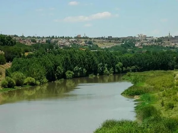
The bottom of the Tigris River, which flows through narrow and deep valleys towards the southeast and parallel to the eastern part of the lava shelf where the city of Diyarbakir is located, descends to 600 meters here.
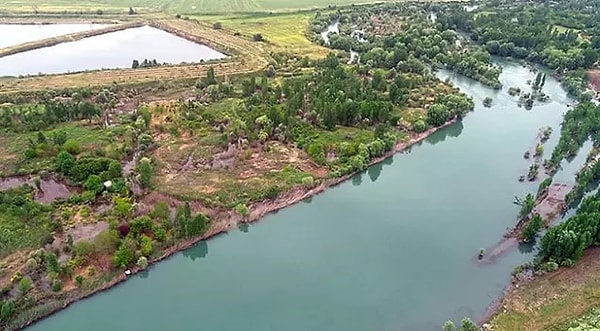
The Tigris River, which heads east at a distance of 8 km to the south of Diyarbakir, descends from the slopes of the Taurus Mountains from the north. It combines Anbar, Kuruçay, Pamuk and Hazroçay with Batman and Yanarsu.
The floodplains Göksu and Savur Stream, which descend from the south and from the threshold of Mardin, join the Tigris. It passes through narrow gorges on the southern slopes of Mount Raman. After merging with Botan Water, it turns to the south.
The river is also very important in terms of forming the 40 km long Turkish-Syrian border from the Cizre Declivity to the Habur Suyu junction as it flows southwards. After merging with the Khabur Water, it enters the territory of Iraq.
The Tigris flows through a depression in the Iraqi soil and crosses narrow gorges. In Mosul, Big and Small are merging with Zap. After landing on the Mesopotamian plain, it is approaching the Euphrates 35 kilometers near Baghdad. Here it joins with the Piyale River coming from Iran. Then he is approaching the Euphrates again. Near Kurna, 64 km above Basra, it merges with the Euphrates, takes the name Shatt al-Arab and flows into the Persian Gulf.
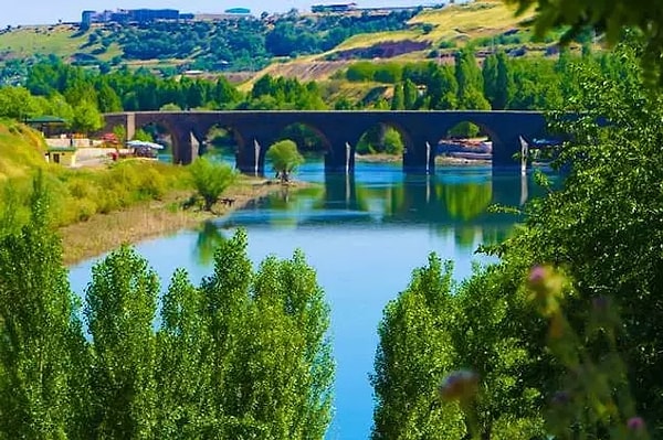
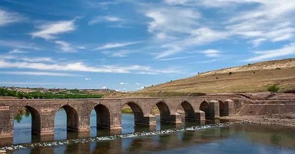
The Tigris River and Hasankeyf
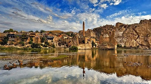
Hasankeyf, a district of Batman province, is one of the most important cultural heritages of the world and the Tigris River also passes through here. The Tigris River, which is home to Hasankeyf, is an important tourist area here.
Especially you can get the chance to visit the Hasankeyf region and see the Tigris River. You can also add pleasure to your enjoyment with fish caught from the river.
Have you ever seen the Tigris River before? Tell us in the comments!
Keşfet ile ziyaret ettiğin tüm kategorileri tek akışta gör!
 Test
Test
 Gündem
 Magazin
 Video
Video


Send Comment